
Southern Utah’s winter weather was predicted to be warmer and drier than the weather southern Utah has received.
In 2022, the National Weather Service and National Oceanic and Atmospheric Administration announced their outlook for the winter season. Both agencies predicted the weather to be warmer and drier in southern Utah.
“These two conditions are responsible for a cyclical weather phenomenon known as the El Nino Southern Oscillation (ENSO),” said Christina Pondell, assistant professor of environmental science. “As a result, we experience either El Nino or La Nino events.”
It was predicted that southern Utah would experience El Nino weather, but this winter season has been La Nino. La Nino weather means “a cold event.”
Pondell said southern Utah doesn’t follow predictable trents when it comes to ENSO. While a warm, dry winter was expected for the southwest, southern Utah does not follow the trend, so the weather we experience is not what had been predicted.
The state of Utah has had six statewide multi-year drought patterns from 1894 to 2017. In 2018, Gov. Gary Herbert declared a state of emergency due to statewide drought conditions.
“Unfortunately, while the moisture is greatly appreciated, one winter with a good amount of rain won’t even dent the realty of the drought Utah, and the entire American West, is currently in,” said S. Alhelí Pendleton, a junior environmental science major from Price. “We are seeing the worst drought over 1,200 years currently, and it’ll take much more than one wet winter to change that trajectory.”
Laura Haskell, drought coordinator of the Utah division of water resources, was interviewed last summer about the increased precipitation in July and August of 2022.
Haskell said: “So [the monsoons] have helped some, but almost 95% of our water comes from snowpack, and that’s what we need to recover from this drought. It takes about as long to get out of drought as it takes to get into it. We’ve been in drought for some [time], and it’s going to take a bit of time to get out of this.”
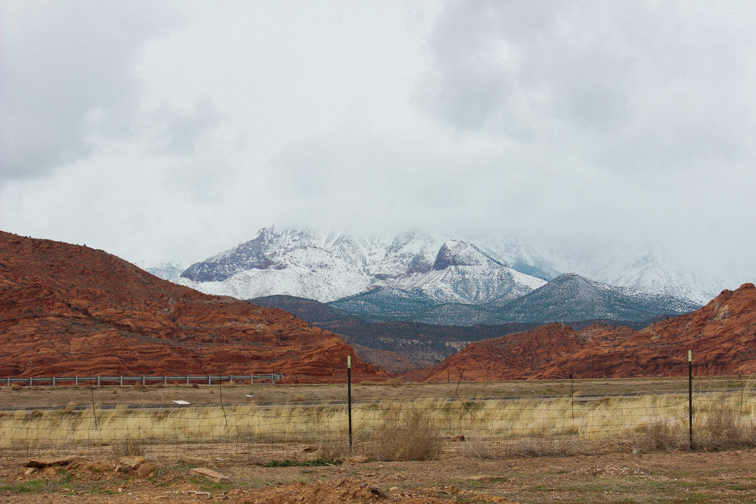
With all the rain and snow since October, the Virgin River Basin has seen just over 20 inches of rain, only a few inches off from the 30-year average of about 26 inches.
“Since a lot of our most recent precipitation has been in the form of snow, and we can see that our mountaintops are still nicely snow covered, there is reason to hope that for the short term the drought conditions may lessen,” Pondell said.
The current outlook for lakes surrounding St. George such as Gunlock State Park and Reservoir, Sand Hollow and Quail Creek is positive. The current capacities of those lakes are high at this time, and the snowpack levels are 222% of “normal” values.
“While these storms have been pretty debilitating for some states, with ridiculous amounts of snow and associated struggles like power outages, we got the good end of the deal and have gotten some much-needed moisture,” Pendleton said.
Pondell said with the high amount of snowpack, which is a primary freshwater source, it’s fair to say the levels of those lakes may increase as the snow melts from the mountains.
“I do think it’s interesting to see that the current levels for Upper Enterprise, Panguitch Lake and Gunlock are higher than previous levels at this time, but Quail Creek, Lower Enterprise and Sand Hollow are at levels at or below previously observed water levels for this time of year,” Pondell said.
Pondell and her students recently started monitoring the Santa Clara River and are excited to collect data to see how the river changes as the winter snowmelt comes down the mountain and through the river.


